By REGINA PALATINI Senior Staff Writer
When we think of the Bermuda Triangle, many of us think of mysteries, myths and legends. Could there possibly be scientific foundations for what is occurring? Should we be thinking instead about scientific explanations?
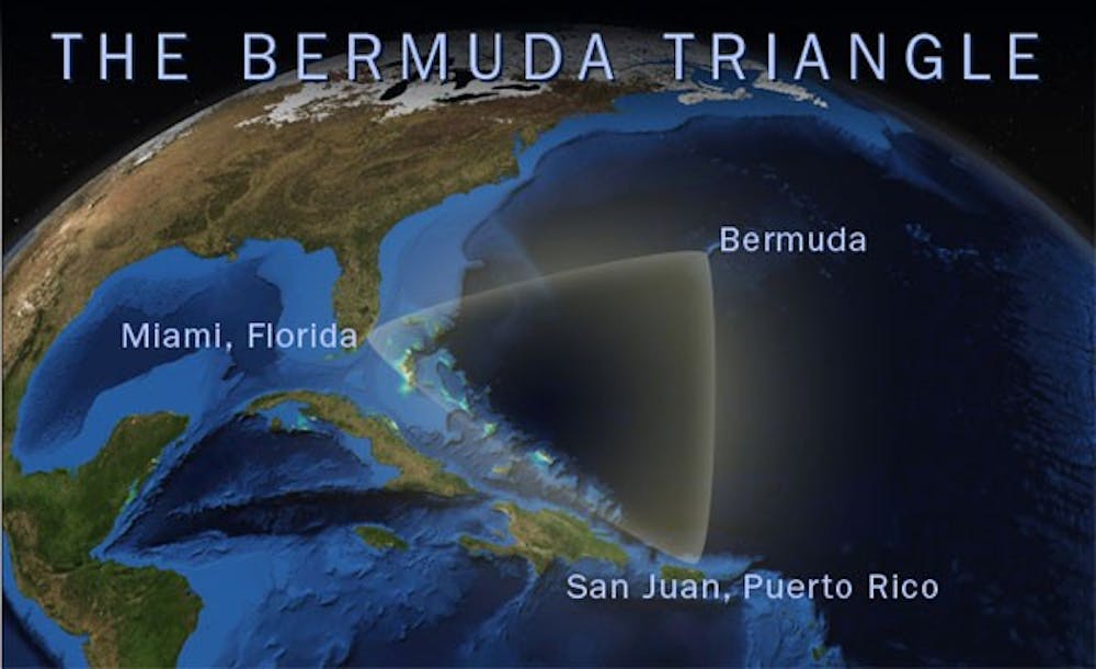
The Bermuda Triangle, also known as the “Devil’s Triangle,” is a mythical geographic region which is defined in the form of a triangle using Bermuda, Miami and San Juan, Puerto Rico as its corners. It is infamous for having a high incidence of unexplained disappearances of aircraft and sea vessels.
According to the History Channel, when Christopher Columbus sailed through the area on his first voyage to the New World, he reported that a great flame of fire crashed into the sea one night and that a strange light appeared in the distance a few weeks later.
An especially infamous tragedy occurred in March 1918 when the USS Cyclops, a 542-foot-long Navy cargo ship carrying over 300 men and 10,000 tons of manganese ore, sank somewhere between Barbados and the Chesapeake Bay. The Cyclops never sent out an SOS distress call despite having been equipped to do so, and an extensive search found no wreckage.
Most of the rational explanations for what occurs in the Bermuda Triangle, such as the reasons given by the U.S. Navy and Coast Guard, include human error and natural environmental effects.
The area experiences violent and unexpected storms and weather changes. These short but intense storms can build up quickly, dissipate rapidly and go undetected by satellite surveillance. Waterspouts, which are tornadoes occurring at sea that pull ocean water up from its surface, have been observed in the area. Scientists have also spotted freak waves up to 100 feet high in the area.
Scientists at Cardiff University have learned of large concentrations of methane gas trapped in the ocean floor. Dying and decomposing sea organisms produce this gas. The sediment formed by these organisms contains bacteria that produce methane, which accumulates as super concentrated methane ice, called gas hydrates. Within seconds of a methane gas pocket rupturing, the gas surges up and erupts on the surface without warning. If a ship were in the area of the blowout, the water beneath it would suddenly become much less dense. The vessel could sink, and sediment could quickly cover it as it settles onto the seafloor. Planes flying above could also catch fire during such a blowout. “On several occasions, oil drilling rigs have sunk as the result of methane gas escape,” Bill Dillon, a research geologist with the U.S. Geological Survey, said.
In terms of compass readings, the Bermuda Triangle is one of only two places on Earth where a compass points to true north rather than the magnetic north. If this compass variation is not compensated for, ships and planes could find themselves far off course.
The underwater landscape of the area may also be a reason for wreckage disappearing. It begins as a gently sloping continental shelf and becomes an extremely deep drop-off. Some of the deepest trenches in the world are found in the area of the Bermuda Triangle. Ships or planes that sink into these deep trenches will probably never be found.
The area of the Bermuda Triangle is also one of the most highly travelled by amateur pilots and sailors, and it is one of the most heavily traveled shipping lanes in the world. Statistically, more traffic leads to more accidents and disappearances. While the mysterious stories and legends about disappearances in the Bermuda Triangle can be considered fascinating and entertaining, they can also be easily explained by facts.